
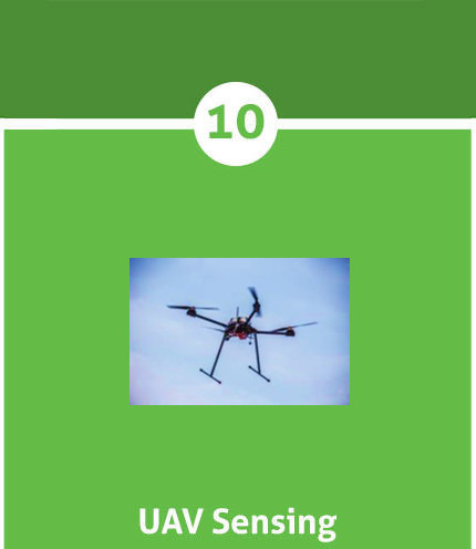
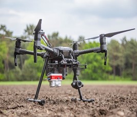
Step 8: UAV sensing
UAV stands for Unmaned Aerial Vehicle and is nothing more than a vehicle flying over a field where photos are taken using a multi-spectral camera. After all photos have been taken, they are merged into an opaque image of the entire plot. The advantage of UAV sensing is that you do not suffer from weather conditions such as cloud, while you can experience problems with remote sensing. With the images obtained via UAV sensing, task cards can be developed by the grower. These task cards can be used for variable fertilization or, for example, for spraying foliage. Below is an image of a drone with a multispectral camera.
Van den Borne potatoes use a lot of drones to map crop growth. Under these drones, 3 different camaras can hang at Van den Borne potatoes:
- RGB camera: With this camera weeds can be recognized on a field.
- Multispectral camera: Cholorophyll or biomass maps can be made with this camera.
- Thermal camera: With this camera the temperature of the crop can be displayed.
With the help of these cameras, a task card can be made for fertilizing or variable spraying of the crop.
Remote sensing:
Remote sensing is a technique in which satellites observe the earth and atmosphere from hundreds of kilometers. The satellites measure radiation data from the Earth's surface and send it back to base stations. Cloudiness disturbs measurement data. The observations are stored and processed into satellite images.
The (polar) satellites used for remote sensing are constantly circling the earth. The satellites contain sensors. They scan the earth's surface piece by piece (10 x 10 m) and measure the light reflected from the earth (B, C and D). The reflection is the ratio of sunlight reflected by the crop and the sunlight incident on the crop. These measurements are then stored as numbers and sent to Earth (E, F). A sensor often measures one wavelength of light (actually: electromagnetic radiation) that reflects the earth's surface, for example only blue or infrared light.

Most Earth observation satellites record in multiple wavelengths, in other words multiple wavelength regions of the electromagnetic spectrum (visible light, near and short wave infrared) are observed by the satellite.
By using the red and infrared bands of a satellite image, an NDVI (Normalized Difference Vegetation Index) can be calculated. The NDVI is believed to be a good estimate of the amount of nitrogen in the leaf. By using other bands, it is possible to determine other parameters. The determined parameters support cultivation measures (G). The figure below shows the principle of remote sensing.


Social media
Bezoekers online: 74